Mapping limb loss in Uganda
It can be difficult to identify people requiring ongoing health support in the aftermath of armed conflict in some parts of the world. One Manchester researcher, Professor Mahesh Nirmalan, has worked with colleagues at the University to increase understanding of who has been affected by conflict in northern Uganda – including those with limb loss – so that they can receive the care they need.
The problem
Undertaking robust studies to determine the health challenges faced by people living in post-conflict environments in the Global South remains difficult. Understanding the extent of any given problem, its severity and its distribution within a given country, or even within a given community, is essential to finding effective solutions.
However, with many of the affected populations living in sparsely populated areas that have limited road and transport networks, identifying truly random samples of people to be included in these surveys isn't straightforward.
The challenge is exacerbated where these regions are 'data poor', lacking census, population and even map data. Such difficulties have previously been overcome by limiting studies to subpopulations living in accessible areas, or even people from subgroups who present to healthcare or other similar institutions.
This process of 'convenience sampling' introduces bias that can make the estimates obtained unreliable.
Limb loss
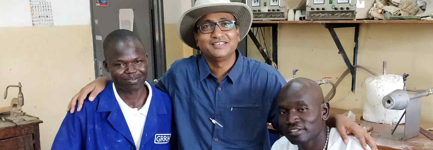
Mahesh Nirmalan, a Professor of Medical Education and Vice Dean for Social Responsibility in the Faculty of Biology, Medicine and Health at The University of Manchester, wanted to understand the extent of post-conflict disabilities, including limb loss, within northern Uganda. This would help see where the University could help in providing rehabilitation services for people affected by a 25-year war between Ugandan government forces and the Lord's Resistance Army.
Given the lack of available map data that existed for the region, however, Mahesh realised he would need expert support. He consequently approached Dr Jonathan Huck, a Senior Lecturer in Geographical Information in the Department of Geography at the University, to see if he would be able to help.
Despite the extensive media coverage at the time about mass killings, displacements of an entire population and physical mutilation of innocent subjects, very little data was available for the government officials to plan and implement a suitable rehabilitation service for the people.
The only facility where prosthetic limb services were available at the Gulu Teaching and Referral Hospital was facing closure, as the international non-governmental organisation (INGO) providing this facility began to scale down its role.
Professor Mahesh Nirmalan
Mahesh is Professor of Medical Education and Vice Dean for Social Responsibility in the Faculty of Biology, Medicine and Health, and Consultant in Critical Care Medicine at Manchester Royal Infirmary.
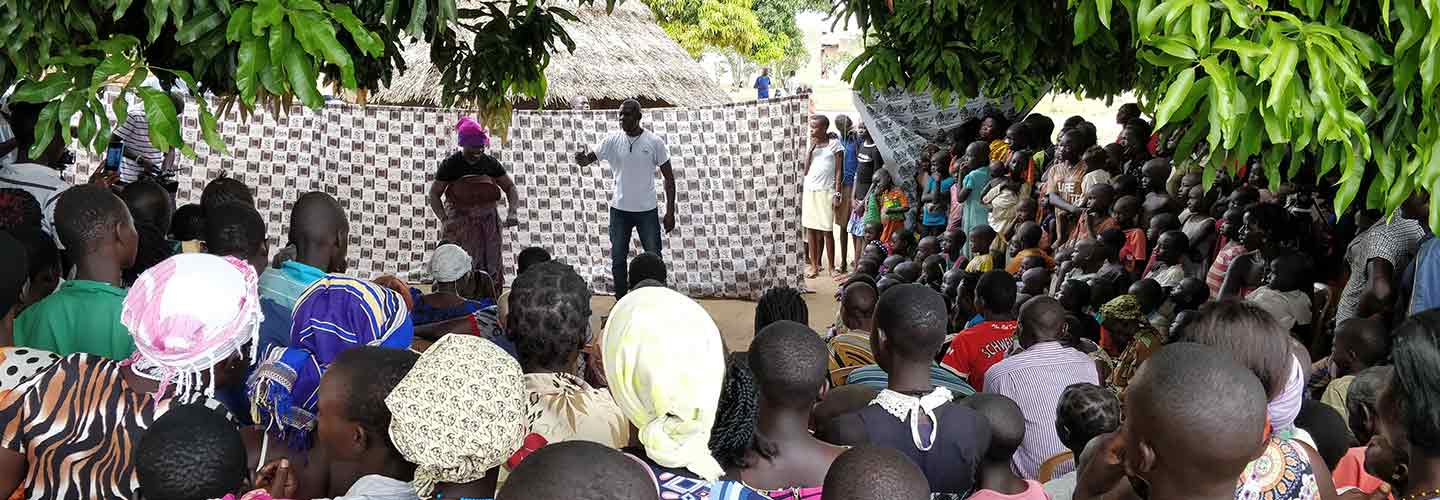
Outreach clinic
Using this method, Jonathan and Mahesh worked in partnership with the Gulu Medical Faculty and the Gulu Teaching and Referral Hospital to map the extent of post-conflict disabilities in northern Uganda.
They also engaged thousands of students and alumni from the University and volunteers through public engagement events, such as the Bluedot Festival, to create freely available maps of the region.
Together, their work provided the rationale to train a team of prosthetic technicians and establish the first outreach prosthetic limb service in Uganda.
To help reduce the stigma felt by people with post-conflict disabilities within the region, they developed a series of street plays and other cultural events with colleagues from the University's School of Arts, Languages and Cultures in the Faculty of Humanities.
COVID in Kenya
Following the success of using GIS-aided studies in Uganda, the team went on to use this technique in three large informal settlements in Kenya to understand people's attitudes to government-imposed public health interventions, such as face masks, hand washing and isolation, during the COVID-19 pandemic.
Informal settlements are characterised by high population density, low urban services, tenure insecurity, poor sanitation, poor ventilation and poor access to even the most basic forms of health services. In 2016, the United Nations estimated that close to 55% of the Kenyan population was living under such conditions.
Again, the team faced the challenge of identifying a truly random selection of people for the interviews. The team in Manchester therefore transferred their experience of GIS-aided studies in Uganda to recruit random samples of residents living within the Kibera settlement in Nairobi, the Rhoda settlement in Nakuru County, and Daraja and Nubian settlements in Kisii County.
This would help researchers understand the competition set up between public health interventions to control a pandemic, and the economic challenges faced by people living in these settlements.
The team are now using GIS technologies to aid their work studying the health impact of increasing salinity in ground water due to rising sea levels in some of the low-lying islands in the Indian Ocean, such as Sri Lanka.
Learn more about Manchester's global health collaborations.